Description
The objective and motivation of this workshop will highlight the latest advances in the design and implementation of IoT devices for mobility that spans air, land, and human interactions. We invite contributions on but not limited to the following topics:
- Design of drone for effective flight and navigation
- Applications of drone & mobile robot navigation through AI and ML
- Vision-based, map-based or landmark-based mobile robot navigation
- Co-operative SLAM
- 3D SLAM
- Fast SLAM for edge deployment
- GPS-denied localization
- Non-Line-of-Sight (NLOS) localization using AI and ML
- Localization using data fusion such as inertial, visual, and time-of-flight sensors
- Wi-Fi, 5G, 6G, Ultra-wideband (UWB) and Bluetooth Low Energy (BLE) localization
- Algorithms and methods for localization and navigation
- Edge computing localization
- Hybrid & Electric propulsion Systems
Important Dates:
- Paper submission:
13 June 2022August 1st, 2022 - Acceptance Notification:
8 July 2022August 16th, 2022 - Camera-Ready Paper Submission Deadline:
31 July 2022August 31st, 2022
Paper should be six (6) pages in length. The conference allows up to two additional pages for a maximum length of eight (8) pages with payment of extra page charges once the paper has been accepted.
Once the paper you submitted has been reviewed and accepted you will be notified about uploading a final version of the paper for publication in the Proceedings and IEEE Xplore.
Chairs
Dr. Yunjia Wang, Professor, China University of Mining and Technology, China
 Yunjia Wang, Ph.D., second-level professor and doctoral supervisor of China University of Mining and Technology, Xuzhou China. He is the National Outstanding Doctoral Dissertation Award, National Excellent Teacher, Special Government Allowance of the State Council, Sun Yueqi Youth Science and Technology Award, Jiangsu “333 Project” Young and Middle-aged Science and Technology Leading Talent, Jiangsu University Young Academic Leader, National Surveying and Mapping Geographic Information Technology Contribution Award other title recipients. He used to be the Dean of the School of Environment and Surveying and Mapping, China University of Mining and Technology, and is currently the Director of the Professor Committee of the School of Environment and Surveying and Mapping, China University of Mining and Technology, the Director of the Key Laboratory of Land Environment and Disaster Monitoring of the Ministry of Natural Resources, and the director of the National Mine Measurement Virtual Simulation Experiment Teaching Center. He is also a member of the Surveying and Mapping Science and Technology Discipline Evaluation Group of the Academic Degrees Committee of the State Council, the chairman of the Mine Surveying Professional Committee of the Chinese Society of Surveying and Mapping, and the vice chairman of the China Satellite Navigation and Positioning Association Indoor Navigation and Positioning Professional Committee. He has researched indoor and outdoor seamless positioning, remote sensing and geographic information engineering for many years and presided over or participated in more than 50 key projects of the National Natural Science Foundation of China, general projects, international cooperation projects, National Social Science Foundation projects, 863 projects, National Science and Technology Support.
Dr. Kegen Yu, Professor, China University of Mining and Technology, China
 Kegen Yu received the Ph.D. degree in electrical engineering from The University of Sydney, Australia, in 2003. He was with the Jiangxi Geological and Mineral Bureau, Nanchang, China; Nanchang University, Nanchang; the University of Oulu, Oulu, Finland; the CSIRO ICT Center, Sydney; Macquarie University, Sydney; the University of New South Wales, Sydney; and Wuhan University, Wuhan, China. He is currently a Professor with China University of Mining and Technology, Xuzhou, China. He has coauthored the book Ground-Based Wireless Positioning (Wiley and IEEE Press, 2009) and another book Wireless Positioning: Principles and Practice (Springer, 2018), and has authored the book Theory and Practice of GNSS Reflectometry (Springer, 2021). He has authored or coauthored more than 100 refereed journal articles, including more than 60 IEEE journal articles. His research interests include GNSS-R, wireless positioning, signal processing, and remote sensing. Dr. Yu served on the Editorial Board of EURASIP JASP, IEEE TAES, and IEEE TVT from 2013 to 2017. He is also on the Editorial Board of IEEE ACCESS. He edited the book Positioning and Navigation in Complex Environments (IGI Global, 2018) and another book Indoor Positioning and Navigation (Science Press, 2018). He was the Lead Guest Editor of a Special Issue of Physical Communication, EURASIP JASP, Remote Sensing, and IEEE ACCESS. He is also the Lead Guest Editor of a Special Section of IEEE TAES (open for submissions soon). These special issues/sections are related to positioning and navigation and remote sensing.
Dr. Cheekiat Seow, Assistant Professor, University of Glasgow, UK
 Dr, Chee Kiat, Seow (M’ 02–SM’ 13) received the Ph.D. degree from Nanyang Technological University, in 2009. Before moving into academic and research landscapes, he was once the senior consultant/programme manager and system architect at Defence Science Technology Agency (DSTA) and STE Electronics, Singapore respectively to architect and lead a programme of engineers to revolutionise , instrument the concept and implementation of various wireless communications infrastructure, network and security projects. From 2011 to 2018, he was a senior Research Fellow and then a senior lecturer with the School of Electrical and Electronics Engineering, Nanyang Technological University, Singapore. He is currently an assistant professor at University of Glasgow, School of Computing Science, UK since 2019. His primary research interests comprise of localization methodology/algorithms, physical cyber security, big data and artificial intelligence/machine learning for various applications such as robotics and drone. He is actively involved in the various research projects of Non line of Sight (NLOS) Localization under GPS denied scenarios, SLAM Navigation and GNSS cybersecurity.
Dr. Henrik Hesse, Assistant Professor, University of Glasgow, UK
 Dr Henrik Hesse is Assistant Professor in Aerospace Systems with the University of Glasgow in partnership with Singapore Institute of Technology. Henrik has a PhD from Imperial College London (2013) where he investigated reduced-order modelling approaches for load control in flexible aircraft. During his postdoctoral appointment at ETH Zurich (2014-2016), Henrik developed novel estimation and control methods for the autonomous operation of tethered drones for a wind power prototype system. He has recently ventured into robotics focusing on sensor fusion and localization of unmanned aerial vehicles in GPS-denied environments which led to several titles in robotics competitions. His current research focuses on modelling, design and control of autonomous systems in the context of their practical application.
Dr. Victor Wang, Associate Professor, Singapore Institute of Technology (SIT), Singapore
 Dr Victor Wang is currently an Associate Professor in SIT. He has a PhD in Computational Aerodynamics from Loughborough University (UK), and his main research interest lies in developing numerical methods for Aerospace Applications, such as propulsions systems, wing designs, Flight Dynamics and optimizing flight formations.


Speakers
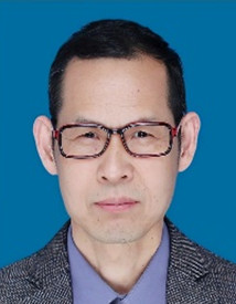
Dr. Kegen Yu, Professor

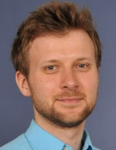
Dr. Cheekiat Seow

Workshop Programme
Organized on – 7th November 2022 at 15:00 – 17:00 JPT
| Time (JPT) | Description | |
| 15:00 | 15:05 | Welcome and Introduction |
| 15:05 | 15:50 | Land Application of GNSS Reflectometry
Guest Speaker: Professor Kegen Yu: China University of Mining and Technology, Xuzhou, China
Abstract: GNSS reflectometry (GNSS-R) is an emerging remote sensing technology, which has been widely investigated especially over the past two decades. Many spaceborne missions, airborne and ground-based experiments have been conducted and a large amount of data have been recorded. In this presentation, we will first talk about some fundamentals of GNSS-R and then focus on two specific land application examples of this technology. One is land snow depth measurement and the other is soil moisture measurement. After studying the basic theory of retrieving the two parameters, we will present some experimental results.
|
| 15:50 | 16:20 | GNSS Vulnerability
Guest Speaker: Assistant Professor Chee Kiat Seow: University of Glasgow, UK
Abstract: Global Navigational Satellite Systems (GNSS) are used to provide accurate time synchronisation and location information for various position, velocity and timing (PVT) application such as 5G cellular timing and autonomous vehicles/drones. However, GNSS signal is highly vulnerable to malicious jamming and spoofing compromising its safe usage especially on finance and smart transportation applications besides national security. This talk will give an introduction on GNSS vulnerability such as spoofing and share various few integrity protection mechanisms of the GNSS.
|
| 16:20 | 16:40 | Perching Drones for Distributed Communication Systems in IoT Applications
Jingmin Liu: Singapore University of Technology and Design, Singapore Wilson Yik: University of Glasgow, UK Bernard Saw: Singapore Institute of Technology, Singapore Henrik Hesse: University of Glasgow, UK
|
| 16:40 | 17:00 | Enhancing UAV Flight Safety through Sensor-based Runtime Risk Assessment
Yong Zhi Lim: Singapore University of Technology and Design Xin Xin: TUV SUD Asia Pacific Teck Ping Khoo: TUV SUD Asia Pacific
|
| 1700 | 1705 | Conclusion and Final Remarks |
If you have any questions, please contact Dr. Chee Kiat: cheekiat.seow@glasgow.ac.uk


